Partnered with #1 ADU Builders
20 Jun
- Golden State Design & Engineering
- Comment 0
Lot Line Adjustments 101: A Guide for California Property Owners
Lot line adjustments 101 is a valuable resource for California real estate law and property owners looking to manage land boundaries efficiently. Whether you’re dealing with agricultural or forested lands or rural areas, facing issues where you inadvertently cross property lines, or preparing for California real estate transactions, a boundary line adjustment permit can streamline land management practices while enhancing property utility. This in-depth guide explains everything from legal requirements to practical steps, ensuring California property owners understand the boundary line adjustment process and its role in facilitating property sales and improving land management.
What Is a Boundary Line Adjustment?
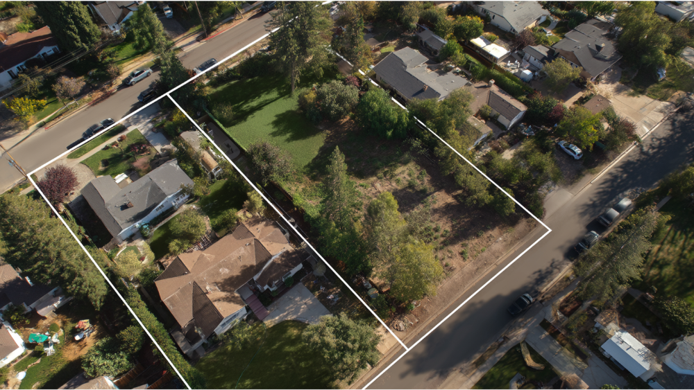
A boundary line adjustment, also known as a lot line adjustment, allows California property owners to shift shared property boundaries without creating new parcels. It enables the legal reconfiguration of property lines between properties involved, correcting property boundaries to align with recorded deeds, legal documentation, or desired land use. This process helps to legally rectify issues caused by outdated surveys or historical land use patterns and plays a key role in development law and rural land management practices.
Why California Property Owners Use Line Adjustments
Boundary line adjustments provide significant benefits for property owners. They help avoid future disputes, facilitate property sales by generating more marketable parcels, correct property lines when boundaries affect access or wastewater systems, and promote ensuring sustainable development. A detailed and precise survey ensures the proposed adjustment complies with local zoning laws, municipal permits, and regional environmental district environmental commission standards.
Legal Framework Under California Real Estate Law

Boundary line adjustments in California are regulated under state development law, municipal local planning, and zoning board oversight.
California Real Estate Transactions and Requirements
Any adjustment must comply with California law and California real estate transactions standards. This includes having legally recognized new property boundaries, recorded deeds, and legally prepared maps. A boundary line adjustment permit is often required to demonstrate that the proposed adjustment does not adversely affect on-site wastewater systems or protecting public health.
Role of Municipal Permits and Environmental Agencies
Adjustments may require municipal permits, including reviewing wastewater systems and zoning board approval. In certain cases, regional environmental agencies and the California Department must review the project, particularly when environmental conservation or forested lands are involved. This ensures compliance with environmental standards and implement sustainable practices to protect groundwater and streams.
Benefits of Boundary Line Adjustments
Boundary line adjustments offer a valuable tool for improving land management and streamlining land divisions. They avoid the complexity of subdivision while providing key benefits such as:
- Streamlining Land Management Practices – They simplify property tax assessments, ease upkeep in agricultural or rural areas, and support implementing sustainable practices.
- Enhancing Property Utility – Reallocating space can adjust property sizes, make backyard space useable, optimize utility access, or balance lot shapes for development.
- Facilitating Property Sales – New property lines and legally recognized parcels often command higher values, especially for development or rural use.
- Maintaining Environmental Standards – Adjustments that affect on-site wastewater systems or forested lands undergo environmental review for protecting public health.
- Preventing Future Disputes – With clear boundaries based on certified surveys, property owners can avoid boundary disagreements.
Eligibility and Key Requirements
Legal Parcel Status and Ownership
All existing parcels involved must be legal and recognized through recorded deeds or certificates. If not, affected parcels may need title clarification or a Certificate of Compliance first. Property owners must consent and provide other relevant documentation.
Survey and Site Plan Requirements
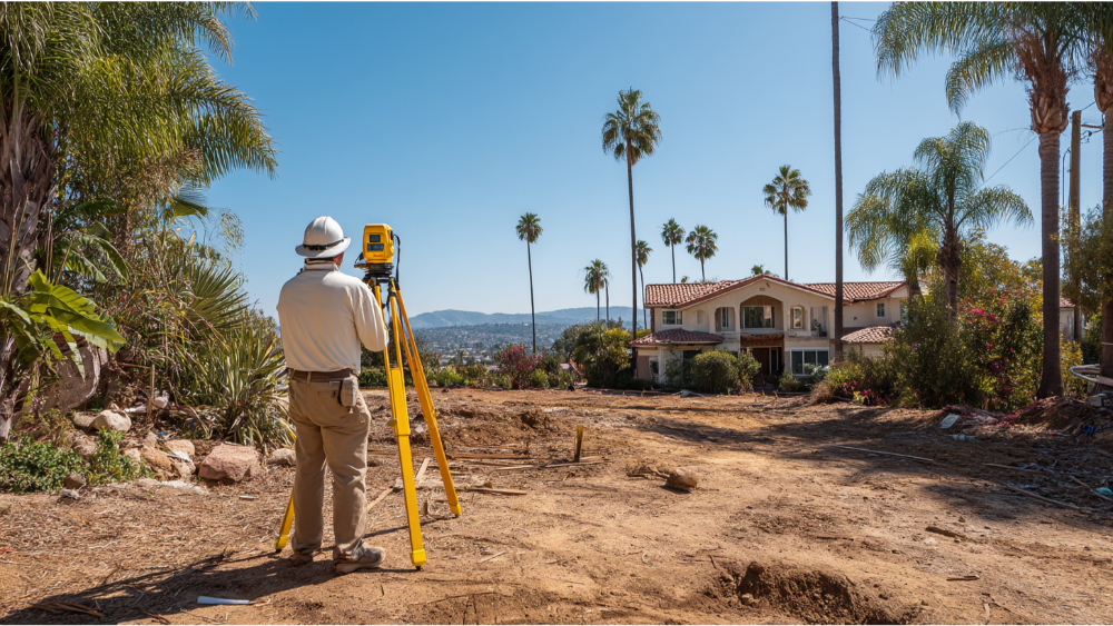
Boundary line adjustments require a detailed and precise survey prepared by a land surveyor or civil engineer. The survey must reflect current property lines, new property boundaries after adjustment, locations of potable wells, existing wastewater systems, utilities, and any physical improvements. A plot map or detailed site plan is essential for permit review.
Zoning Compliance and Municipal Requirements
Adjustments are subject to local zoning laws and may require zoning board review or approval from the municipal board. They must not violate local regulations, agricultural uses, or environmental protections. Ensuring zoning approvals and obtaining municipal permits is an essential step.
Wastewater Permit Reviews
If the adjustment affects existing wastewater systems or on-site septic infrastructure, a wastewater permit review is necessary. County health officers or state agencies will verify compliance and protecting public health requirements.
The Boundary Line Adjustment Process
1. Pre‑Application and Planning
Property owners should begin with verifying that parcels are legal and reviewing regional zoning regulations. Engaging with the municipal planning or zoning board ensures understanding of required other relevant documentation, fees, and environmental considerations. Consulting a land surveyor early can clarify boundary discrepancies and provide a site plan tailored for permitting.
2. Survey and Site Planning
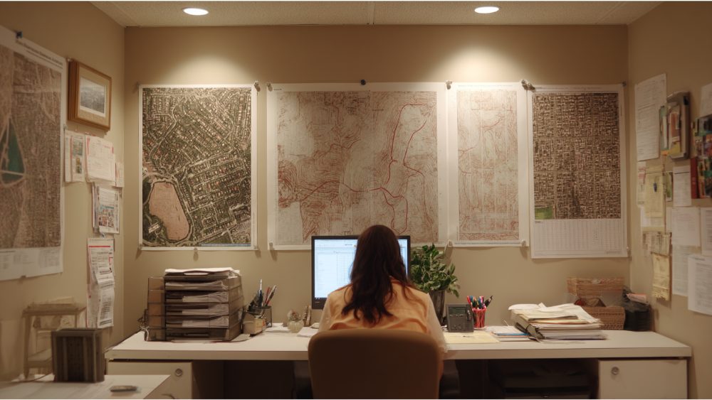
A comprehensive survey establishes existing property boundaries, corners, and easements. Surveyors produce legal documentation, including new metes and bounds, maps, and a detailed site plan showing new property lines. These tools ensure the boundary line adjustment process is legally compliant.
3. Application for Boundary Line Adjustment Permit
Applications must include:
- Legally prepared survey and site maps
- Recorded deeds and legal documentation
- Boundary line adjustment form signed by all property owners
- Evidence of compliance with wastewater reviews
- Fee payment
- Any consent from utility companies or easement holders
4. Agency Review and Decision
Municipal board or zoning board reviews the application and evaluates whether the proposed adjustment complies with local regulations, protects public health, and maintains environmental conservation. In more complex cases, regional environmental agencies may conduct a review to ensure compliance with state standards and ensuring sustainable development.
5. Recordation and Finalization
If approved, owners must record updated deeds, revised site plans, and any Certificates of Compliance. This ensures the new property boundaries are legally recognized. The process is completed once records are filed and the county or city clerk updates parcel records.
Timeline and Costs

Processing Times
In simple cases, permit applications are often reviewed within 30 to 60 days. For adjustments affecting forested lands or wastewater systems, approvals can take 90 days or more due to additional reviews.
Typical Costs
Costs include land surveyor fees, permitting fees, and recording fees. Typical expenses range from $1,500 to $5,000 depending on complexity. Additional costs may arise for wastewater permit review or environmental agency fees. Boundary line adjustments often cost less than subdivision and may provide fee waivers for agricultural or rural areas or conservation lands.
Frequently Asked Lot Line Adjustment Questions
Do boundary line adjustments create new parcels?
No, they only adjust boundaries between existing parcels and do not increase parcel count.
Can I adjust my boundary if I cross property lines?
Yes, boundary line adjustments can correct or realign boundaries, avoiding disputes or encroachments.
Will a boundary adjustment affect my wastewater system?
Potentially. Projects near existing wastewater systems require wastewater permit review to ensure compliance with health standards.
Do I need permission from neighboring landowners?
Yes, all property owners involved must sign the application and consent to changes.
How soon can I close a real estate transaction after an LLA?
Once documents are recorded and municipal records updated, the property can be sold. A clear boundary line adjustment can facilitate property sales promptly.
Are there environmental review requirements for forested or agricultural lands?
Yes, adjustments affecting such lands may need environmental reviews by state or regional agencies to protect land management practices.
How GSDE Supports California Property Owners
Golden State Design & Engineering partners with California property owners to simplify the boundary line adjustment process. Our integrated services include:
- Legal documentation and surveyor coordination
- Detailed site planning and map preparation
- Municipal permit application and tracking
- Wastewater and environmental compliance
- Assistance with recorded deeds and final recordation
We ensure boundary line adjustments comply with California real estate law, rely on sustainable practices, and support efficient land management practices.
Conclusion
Lot line adjustments is an essential concept for property owners across California, especially in agricultural or rural areas. By using boundary line adjustments, landowners can streamline land management practices, enhance property utility, correct property lines, and facilitate property sales while avoiding subdivision complexity. When paired with certified surveys, municipal permits, wastewater permit reviews, and legal documentation, this process offers an efficient way to manage California’s land carefully and responsibly.
The key steps involved in this process are critical for success, and consulting with experienced professionals like the Peet Law Group can provide valuable guidance and ensure compliance with all regulations. Understanding the role of the district environmental commission is also a key consideration in environmental reviews. By following these steps, property owners can confidently manage their land and avoid future disputes.
If you are a California property owner contemplating new property boundaries or dealing with outdated surveys, contact GSDE today. Our team can guide you through the full boundary line adjustment process, ensuring your project moves forward with confidence and legal clarity.
#NAICS’s:
- 541310 Architectural Services &
- 541330 Engineering Services
DUNS NO:
- 119132267
#SIC’s
- 8712 Architectural Services &
- 8711 Engineering Services
Cage #
- 9R4L5
#UNSPSC’s:
- 81101500, 81101502, 81101505, 81101508, 81101526, 81101533, 81101522