Partnered with #1 ADU Builders

06 Jun
- Golden State Design & Engineering
- Comment 0
How to Read a Parcel Map, a Simple Guide for Property Owners
Whether you are a private property or public property owner, a real estate professional, or involved in real estate transactions learning how to read a parcel map a simple guide for property owners can be an excellent tool to understand property lines, property boundaries, parcel number systems, legal descriptions, flood zones, utility lines, and other essential information related to land management. In this guide we will explain in detail what a parcel map is, how to read it, why it matters, how it differs from a plat map or plot map, and when to get accurate survey data to find property lines with precision for real estate transactions or private property improvements.
What Is a Parcel Map and Why Property Owners Use It

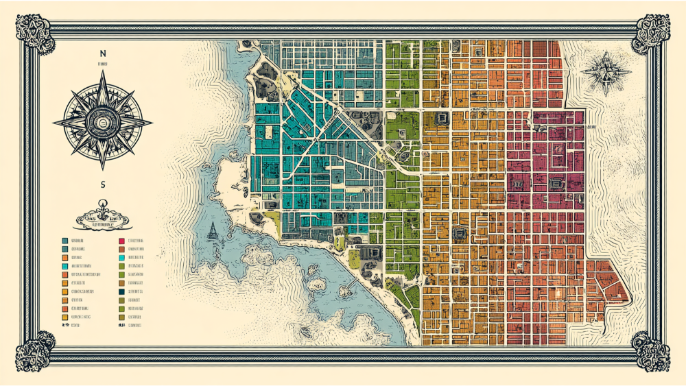
A parcel map is a map drawn or printed to show all the parcels in a defined area for assessment purposes property tax planning or land management. It is prepared by a county assessor’s office with assessment data and tax map information and often used by property owners to get a general idea of property size, parcel size, parcel boundaries, and property line information. Unlike a plat map or plot map which shows divisions of real estate into lots by a developer or surveyor, a parcel map is often based on recorded legal description and often used for tax maps or tax maps referencing parcel identification numbers. Many private property and multiple properties owners rely on map scale, geographic information systems or paper maps to view property characteristics land parcel divisions and individual parcels.
Purpose of a Parcel Map
- Identify property boundaries, parcel size, and property lines for private property or public property interests.
- Provide property owners and assessors with parcel number systems or parcel identification numbers to track property tax and legal description updates.
- Allow multiple properties in an area to be viewed at once such as section maps or section map divisions.
- Support land management by showing block number divisions, lot number layout, and map scale references.
Who Uses Parcel Maps
Most counties provide map access via free access GIS systems or paper maps with section maps and plot maps. Real estate transactions rely on parcel maps, but tax maps or tax maps alone do not always capture utility lines or flood zones or reflect accurate survey data. A title company may use parcel maps when providing title insurance or scattering instruments, but they often need verified survey data to confirm property rights, property line information and exact dimensions.
Difference Between Parcel Maps, Plat Maps, and Plot Maps
- Parcel map – Created for assessment and land management by a county assessor’s office with parcel number, tax map, block number, and parcel numbering system. It shows assessment data, parcel identification numbers, section maps and boundaries.
- Plat map or plat maps – Produced by surveyors when dividing land for development, these maps include legal description, lot number, property line, lot layouts and exact dimensions of individual parcels. Plat maps are filed with the county recorder as official records.
- Plot map – May be used by title company or real estate agents to show the location of improvements like house number, utility lines, and may include flood zones or other features.
Understanding these differences helps property owners avoid discrepancies occur between tax maps and plat maps and know when they need accurate survey data to find property lines.
Key Elements of a Parcel Map Explained
Parcel Number or Parcel Numbers, Parcel Identification Numbers, Parcel Numbering System
A parcel number also called parcel identification number or parcel numbering system, is usually printed on each parcel on the map. In California, the complete parcel number may look like 123‑456‑789‑000. This number corresponds to county, book, page, and individual property. For example code 123 refers to assessor’s office code, 456 refers to map book, 789 refers to page or block number, and final digits identify the individual parcel. Finding your parcel number on the map helps locate your plot map and legal description.
Parcel Boundaries, Property Boundaries, and Property Lines
Solid lines represent parcel boundaries and property boundaries on a parcel map. Property lines, which define private property and public property limits, are shown based on recorded legal description. Dashed lines may indicate easements, utility lines, historical lot lines, or rights-of-way. Map scale indicates how measurements relate to real measurements on the ground. If you need exact dimensions or find property lines with precision, you may require accurate survey data.
Map Scale and Geographic Information Systems
Map scale is the ratio between distance on the map and distance on the ground, often stated as 1 inch equals 100 feet. Geographic information systems provided by most counties allow property owners to view parcel maps online and zoom to plot map details. Section map overlays, flood zones, utility lines, and other features can be toggled to reveal property characteristics and additional information like house number or driveway.
Legal Description, Lot Number, Block Number
Parcel maps may not show full legal description but may include block number and lot number for land parcels. These identifiers correspond to legal description in deed or title company documents. Legal description defines property rights in a way recognized for real estate transaction or property tax assessment. Always verify legal description matches parcel map information and ensures consistency.
Flood Zones, Utility Lines, and Other Features
Some GIS systems include flood zones overlays showing flood risk and utility lines for water, power, gas. However parcel maps are primarily for assessment purposes and may not show all utility lines. For detailed utility location or flood zone confirmation you may consult a title company, surveyor, or get accurate survey data.
How to Access and Use Parcel Maps as a Property Owner

Most counties provide free access to parcel maps through GIS mapping systems. These interactive portals allow property owners to search via parcel numbers, address, house number or by selecting on-screen. A tax map or GIS portal shows parcel boundaries, block number, lot number, utility lines and flood zones. Public records are integrated so users can view official records of legal description, property size, parcel size, and property rights.
Using Online Parcel Viewers
- Visit the county assessor’s office website and navigate to the GIS mapping or parcel map portal.
- Enter your address, house number, or parcel identification numbers.
- View the interactive parcel map, including property lines, section maps, and flood zones.
- View adjacent properties, multiple properties, and general idea of property boundaries.
- Export or print a plot map or tax map.
- Double check the parcel number matches legal description and assessment data.
Accessing Paper Maps and Official Records
If you prefer paper maps, visit the county assessor’s office or recorder’s office. You can request a plot map or recorded plat map, or look up official records. Some older plot maps or paper maps show section maps and lot number layout. Many parcels are divided and a tax map may include multiple parcels. You can find parcel size and location but verifying exact dimensions requires accurate survey data.
Limitations of Parcel Maps for Property Owners
Parcel Maps Are Not the Same as an Accurate Survey
Parcel maps provide a general idea of property boundaries, land parcel division, and block number but are not derived from on-the-ground measurements. They reflect assessment data or tax maps, not field‑verified boundary surveys. Discrepancies occur especially when parcel lines cross uneven terrain or were recorded decades ago. If you want to locate property lines accurately, hire a licensed land surveyor to obtain accurate survey data down to metal rods in the ground.
Parcel Maps Don’t Define Legal Property Rights
Parcel maps do not guarantee property rights, legal property boundaries, or legal description accepted in court. A parcel can appear legitimate on a tax map but be a non-conforming private property or legal parcel that lacks proper subdivision approval. Real estate transactions hinge on legal parcel recognition. Title companies rely on legal description, plat map, and survey data to issue title insurance or confirm property boundaries.
Limited Detail on Easements, Utility Lines, and Flood Zones
Parcel maps may not include easements or utility lines. While some geographic information systems overlay these features, many tax maps do not. If a utility easement crosses private property or there are flood zones or public property boundaries adjacent to your land parcel, you need to consult recorded easement documents or fetch accurate survey data.
When to Call in Professionals for Accurate Survey Data

Land Surveyor or County Plat Map Help
If you need to find property lines, determine property size, code compliance, or prepare for construction, a licensed land surveyor should be your go‑to resource. A surveyor will use accurate survey data to locate boundary markers and metal rods on your land parcel. They will prepare a detailed plat map or section map and provide a legal description accepted by title company or for real estate transactions.
Civil Engineer and Legal Description Verification
Planning to build on private property or subdivide? You need legal description verified against parcel map and plat map. A civil engineer working with GSDE can verify property lines, property size, parcel size, utility lines and flood zones. We assist with land management, permitting, lot number consistency, and legal description confirmation.
Title Company and Real Estate Transactions
In any real estate transaction or sale title companies require legal description, accurate survey data, complete parcel number and property lines. A parcel map alone won’t suffice. During due diligence, title companies check public records, paper maps, tax maps, flood zones, and legal description to confirm property rights.
Frequently Asked Questions: Parcel Maps and Property Lines
How do I find property lines if I only have a parcel map?
You need accurate survey data. Parcel maps provide approximate property boundaries but only a licensed surveyor can locate metal rods marking property corners.
Are parcel maps and tax maps the same?
Yes parcel maps are often tax maps, created for assessment purposes using parcel identification numbers. However tax maps may omit details like easements and utility lines unless integrated in GIS mapping systems.
Can I use a parcel map as a legal description?
No legal description must reference lot, block, section, township, meridian, or recorded document. Parcel maps show parcel boundaries but do not offer sufficient legal description accepted by title companies.
What if there are discrepancies between the parcel map and the plat map?
Discrepancies occur when parcel maps are outdated or measurement methods differ. Consult a surveyor to reconcile differences and confirm property boundaries.
Do parcel maps show flood zones and utility lines?
Some GIS systems overlay flood zones and utility lines on parcel maps. However they are not considered reliable without survey data and official easement documentation.
Do I really need a plat map?
If you are subdividing land parcel, engaging in real estate transaction, or require precise boundary location you need a recorded plat map prepared by a licensed surveyor. Parcel maps do not suffice for these purposes.
How can I double check my parcel number?
Use the assessor’s office GIS mapping system, enter your address or house number, and verify your parcel identification number matches your tax bill, legal description, and parcel map.
Will the parcel map show changes if my land is divided or merged?
Parcel maps are updated periodically but may not reflect recent changes. Use recorded plat maps, legal description or the assessor’s office to confirm.
What other forms of mapping should I consult?
In addition to parcel maps, consult plat maps, gauge cadastral maps, section maps, flood zone maps, utility line maps, and geographic information systems for a more complete understanding.
Using Mapping Systems and GIS for Parcel Information
Mapping systems like geographic information systems (GIS) integrate multiple data layers including parcel number, lot number, flood zones, utility lines, section maps, block number layout and other features. This free access tool allows property owners to:
- View individual parcels and plot map information
- Zoom in to find property characteristics
- Overlay flood zones, utility lines, and more
- Print plots or export tax map data
- Compare multiple properties side by side to see if any discrepancies occur
GIS is an important complement to paper maps or official records when using parcel maps in the same manner as in real estate transactions or property ownership.
Final Thoughts on Parcel Maps and Property Line Information
Parcel maps are excellent tools to get a general overview of your land parcel, how parcel boundaries relate to adjacent parcels, your complete parcel number and property tax information. But they have significant limitations when it comes to property rights, legal description, property line accuracy, utility lines, flood zones and real estate transaction requirements. To find property lines, ensure legal property rights, or proceed with development or sale you need recorded plat maps, accurate survey data, legal description, and title company support. GSDE’s licensed land surveyors and civil engineering team can provide accurate survey data, prepare plat maps, verify legal description, and assist with GIS mapping systems so property owners have reliable information they can build on or transact with confidence.
Contact GSDE for Accurate Survey Data and Civil Engineering Services
When your project depends on precise boundaries, developable land parcels, accurate survey data or legal description accepted by a title company, trust GSDE to help you through every step. Contact us today to schedule a land survey or plat map consultation and be confident in your property lines for planning, building, or real estate transactions.
#NAICS’s:
- 541310 Architectural Services &
- 541330 Engineering Services
DUNS NO:
- 119132267
#SIC’s
- 8712 Architectural Services &
- 8711 Engineering Services
Cage #
- 9R4L5
#UNSPSC’s:
- 81101500, 81101502, 81101505, 81101508, 81101526, 81101533, 81101522